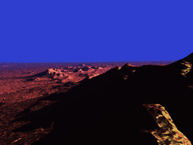
| Arizona sunset | Click on the image to see a larger version |
This image is an experiment in large-scale object modeling, created using freely accessible USGS Digital Elevation Map data.
The data I’ve used here covers an area 20 miles square, accurate to 250 feet horizontally and capable of one inch vertically. (If you look closely at the horizon you can see the edges of the model, beyond which is a black and white checked plain.)
In the yellow area at the bottom right you can see several of the rows of data. Each of these rows is 250 feet wide.
If I were to continue work on this image I would be inclined to add vegetation or man-made objects to indicate scale.


